|
search place name
|
||
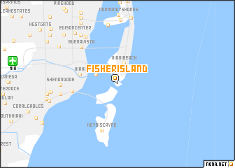
Fisher Island (Florida, United States - USA)Fisher Island is a town in the Florida region of United States - USA. An overview map of the region around Fisher Island is displayed below.
regional and 3d topo map of Fisher Island, United States - USA ::
nearby GPS traces from timatio ::
Fisher Island airports ::
The nearest airport is MIA - Miami Intl, located 15.5 km west of Fisher Island.
Other airports nearby include FLL - Fort Lauderdale Hollywood Intl (34.6 km north), HST - Homestead Arb (38.8 km south west), BIM - Alice Town South Bimini (88.1 km east), PBI - West Palm Beach Palm Beach Intl (102.3 km north), Nearby towns ::
Miami Beach (3.5km north) //
Port of Miami (3.4km north west) //
Miami (5.6km west) //
Brickell Hammock (6.6km west) //
Key Biscayne (7.8km south) //
Buena Vista (7.8km north west) //
Bayshore (8.8km north west) //
Lemon City (9.4km north west) //
Edison Center (10.1km north west) //
Liberty Square (11.0km north west) //
[all distances 'as the bird flies' and approximate]  Places with similar names to Fisher Island, United States - USA :: Disclaimer :: Information on this page comes without warranty of any kind |
||
|
Where is Fisher Island? Elevation and coordinates ::
Latitude (lat): 25°45'38"N Longitude (lon): 80°8'25"W
Elevation (approx.): 10m (map arrows pan, magnifying glasses zoom) |
||
|
Visiting Fisher Island? Hotel/Accommodation ::
Book a hotel in Fisher Island Travel Guide ::
rental cars ::
car rental offers GPS waypoint ::
download a GPX waypoint (PoI) of Fisher Island for your GPS receiver
|
||